A Station Change, Read from the Platform Map
A station plan is more than a picture of the tracks. Read its labels, entrances and crossings in the right order, and a connection becomes a place you can understand before you arrive.
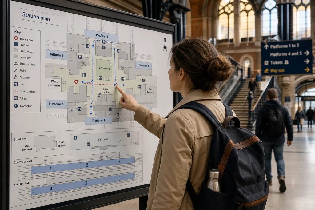
A platform map tells you where a station’s parts sit in relation to one another; it does not, by itself, tell you how to get between them. That distinction matters when a connection depends on moving from one platform to another. Read the plan as a diagram of spaces and routes, then check the station’s signs and live information for the instructions that apply on the day.
Start with the station
Find the station name first. Maps are sometimes displayed beside a particular entrance or concourse, and the drawing may be oriented to match the view from that spot. A north arrow, a compass symbol or a small “you are here” marker can tell you how the page relates to the ground. Without one, the top of the page may simply be the top of the page.
Look for a legend. It explains the map’s symbols: stairs, lifts, escalators, ticket barriers, toilets, entrances and other facilities may each have their own mark. The symbols can be small, and two different features may look similar. Do not infer a route from an icon until you know what it represents.
Then locate the features you actually need: your arriving platform, your departing platform and the station’s public circulation space. That space may be called a concourse, booking hall, ticket hall or simply the entrance area. A map may show several named areas. If so, note which one connects the platforms in question.
Station plans vary in detail. Some show every passage and door; others simplify the building into a few blocks. Track lines may be drawn in parallel even where the platforms are separated by a large building, a road or more than one level. Treat the drawing as a guide to relationships, not as a scale model.
Read the platforms
Platform numbers usually identify the places beside the tracks where passengers board. They are not necessarily arranged in the same order as the tracks appear on the map. A pair of tracks may share an island platform, with a platform face on each side. Elsewhere, two platforms face one another across tracks, or sit on separate levels.
Notice whether the map labels a platform, a track or a platform face. These are related but not interchangeable terms. A train may use a platform face that serves one direction at some times and another direction at others. The map describes the station’s layout; departure boards and platform announcements identify the service’s current boarding place.
Find your two platform labels, then trace the spaces between them. Can you see a passage linking them directly? Does each lead to the same concourse? Is there a marked route through a footbridge, underpass or ticket barrier? These are more useful questions than asking whether the platforms look close together on the page.
A direct link is not always the route passengers are allowed to use. A gate may be staff-only, a passage may serve one direction, or a platform may be accessible only from one end. If the map marks access restrictions, follow them. If it does not, use the station’s signs rather than trying a door that seems promising. Railway buildings have a long history of doors that look more helpful than they are.
Trace the public route
To understand a change, follow a continuous path from the arriving platform to the departing one. A common route runs from the first platform up or down to a footbridge or underpass, across the tracks, then back to platform level. Another may lead through the main concourse and ticket barriers. A large station can offer several routes, but only some connect the areas you need.
Read the route in pieces. Start at the platform entrance or exit shown on the plan. Follow the path to the first junction. Identify whether it goes upstairs, downstairs or through a level passage. Continue to the next clear landmark, such as the concourse, a barrier line or a named exit. From there, follow signs to the new platform.
When several arrows or corridors appear, look for the labels that match the facilities and destinations you have identified. A route towards the street may not lead to another platform. A passage marked for a particular exit can take you outside the station, even if that exit is near the platform you want. If you must pass through ticket barriers, check whether the map indicates an internal route or a route that takes you out and back in.
Say you arrive at Platform 2 and need Platform 5. On the plan, both are on opposite sides of the station, and a footbridge connects them via the main concourse. You trace the route from Platform 2 to the bridge, cross to the concourse and follow the Platform 5 signs. The useful result is not a prediction that the change will be easy; it is a clear sequence of places to look for, which you can confirm against signs when you arrive.
Notice levels and barriers
Levels are often the hardest part to read because a flat drawing has to represent a building with stairs, bridges and tunnels. Look for labels such as “street”, “concourse”, “platform level” or floor names. A small stair symbol may connect areas that look adjacent on the page but are vertically separated. Lines crossing one another do not necessarily meet.
Some maps use shading, dotted lines or different line styles to distinguish routes. The legend should explain them. If a route is drawn across a track line without a bridge or tunnel symbol, do not assume passengers can cross at track level. In a station, the permitted route is the one indicated by the public path, not the shortest line your finger can draw.
Ticket barriers are another important boundary. A station plan may place the concourse inside the barriers, outside them, or show both sides. If you stay within the station during a change, the map can help you identify an internal route. If the only marked path appears to leave the paid area, check with staff or the operator before relying on it. Ticketing rules and barrier arrangements differ between stations.
For step-free travel, look specifically for lift symbols and the route they connect. A lift near a platform does not prove that every onward passage is step-free. Follow the accessible route from platform to concourse and onward to the next platform, checking whether each part is shown as connected. If the map is unclear, ask station staff or contact the operator before travelling. Accessibility information is more useful when it describes the whole journey through the station, rather than one isolated lift.
Separate layout from service
A platform map is a plan of fixed spaces. It cannot tell you that a train is delayed, that a platform has changed, or that a corridor is temporarily closed. Those details belong to live departure boards, announcements and station staff. Use the diagram to understand the building, then use current information to confirm the train and route.
Even the platform number on a ticket or journey planner may not settle the matter. Some services show a platform only shortly before departure; some stations use different platform arrangements during disruption. Check the board for the train’s destination and departure time, not just a familiar-looking service name. If the platform changes, revise the route through the building as well as the boarding point.
There is little value in memorising every corridor before setting out. It is enough to recognise the main landmarks and know which direction to look for the next sign. Nor is it worth estimating a change from the apparent distance between two labels on a schematic map. That can make a short-looking route seem certain when stairs, barriers or a busy concourse are involved.
Use the map well
Before travelling, save or open the station plan from the station or rail operator’s official information. Check that it covers the station’s main public areas and that the platform labels are legible. If you are viewing a printed plan, note the “you are here” marker before turning the page or comparing it with a phone screen.
At the station, match the map to visible signs. Names such as “main concourse” or “Platform 5” provide a useful check that you are reading the right area. If the diagram and the signs seem to disagree, trust current station directions and ask a member of staff. The plan may be simplified, or part of the station may have changed.
A platform map is most helpful when it gives you a mental sequence: platform, passage, level change, concourse, next platform. It will not remove every uncertainty, and it should not replace live information. But once you know what the symbols and boundaries mean, the station stops being a collection of numbered edges and becomes a set of connected spaces. That is a modest advantage, though a welcome one when the train is waiting on the other side of the footbridge.
Another stop nearby
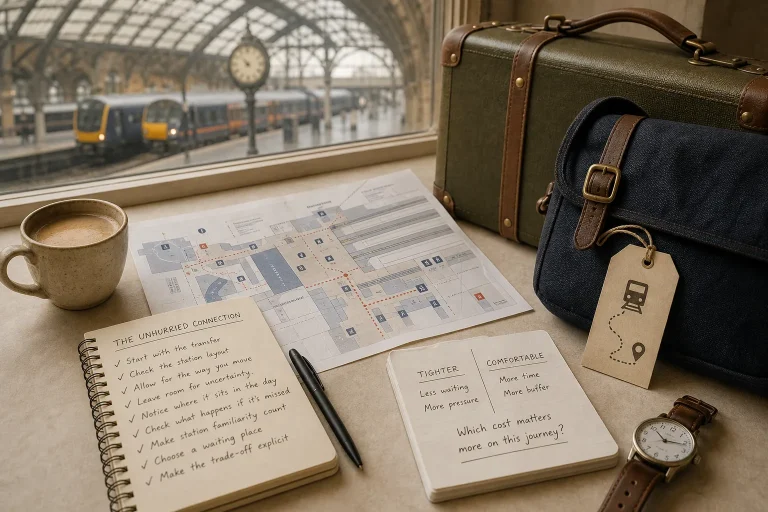
The Unhurried Connection: Leaving Space Between Trains
A comfortable rail connection is not simply a long wait. Match the gap to the station,…

A Long Ride Without a Packed Schedule
A fictional journey shows how a few gentle anchors—food, rest and looking out—can give a long…